ALTEMIS Fieldwork Highlights SRNL Collaboration
Researchers from Lawrence Berkeley National Laboratory (LBNL) and Canadian Nuclear Laboratories (CNL) visited Savannah River Site (SRS) February 27-29 to participate in fieldwork for the Advanced Long-Term Environmental Monitoring Systems (ALTEMIS) project.
ALTEMIS uses artificial intelligence and machine learning to strategically use parameter sensors at contaminated sites. This reduces the number of monitoring wells required and decreases the sampling frequency, while providing the same level of monitoring.
The ALTEMIS testbed is located in SRS’s F-Area Seepage Basins, which received low-level acidic waste between 1955 to 1988, as well as the wetlands associated with nearby Fourmile Branch creek.
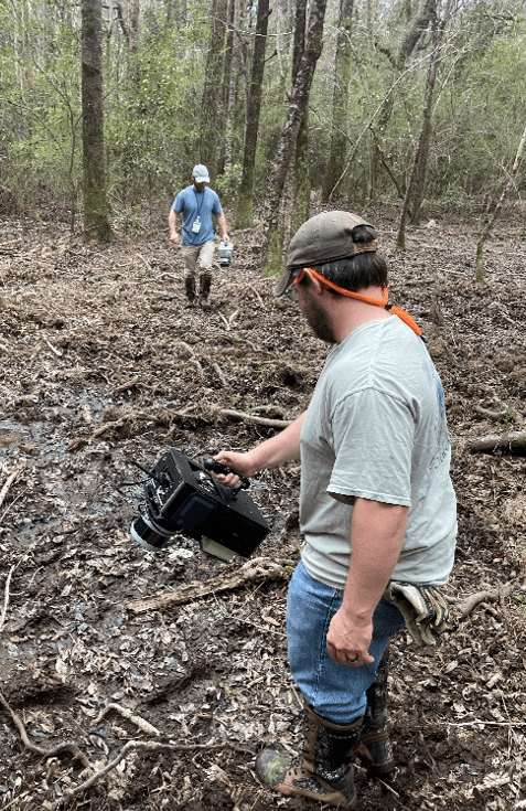
Mapping surficial radioactive contamination in F-Area wetlands. Photo by Hansell Gonzalez-Raymat (SRNL).
The sensor network for ALTEMIS is fully in place, so the LBNL and CNL teams were at SRS for a follow-up phase of data collection. The LBNL representatives contributed critical instrumentation for the sampling, while the CNL researchers used the opportunity to gain knowledge and experience with ALTEMIS for use at the contaminant plume at CNL’s Chalk River Site.
Fieldwork included mapping surficial radioactive contamination in F-Area wetlands. SRNL’s Austin Coleman and Jordan Floyd traversed the wetlands using hand-held radiation detectors. This allowed the team to characterize contamination via gamma emissions.
The researchers deployed a table-top silicon drift detector in the wetlands to conduct in situ measurements of x-rays and low-energy gamma rays. In particular, this allowed them to characterize contamination from iodine-129, an isotope of concern in the area.
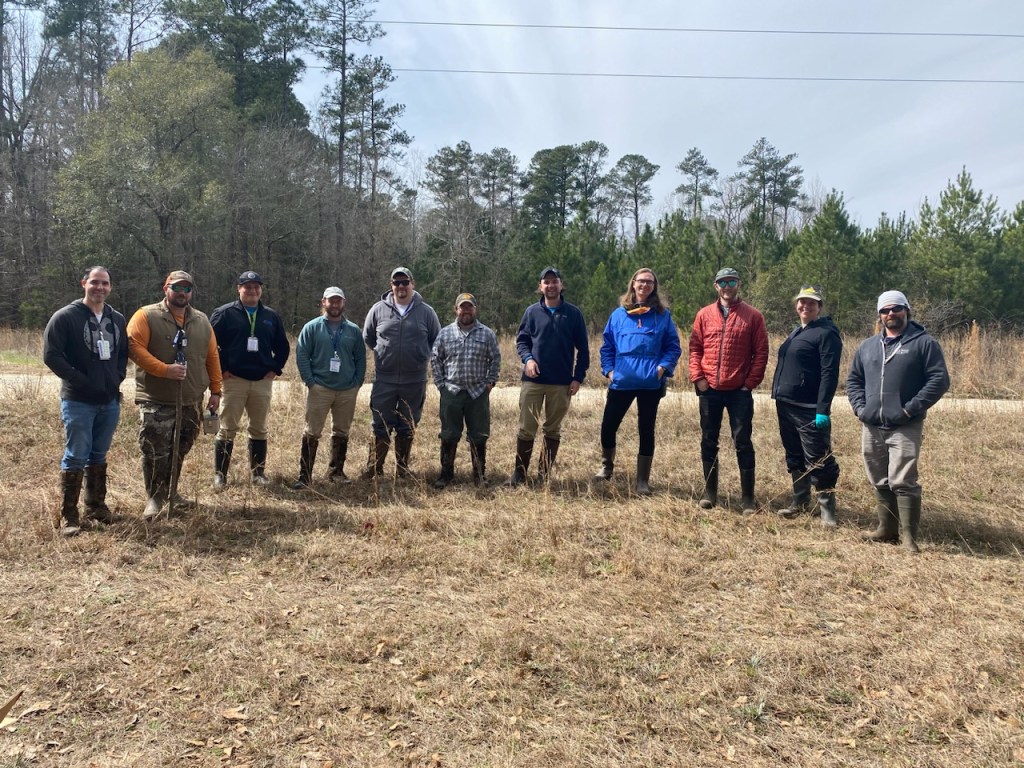
Left to Right: Hansell Gonzalez-Raymat (SRNL), Brian Jones (SRNS-EC&ACP: RadCon), Kevin Boerstler (SRNS-EC&ACP), Jordan Floyd (SRNL), Evan Koelker (SRNL), Austin Coleman (SRNL), Andrew Hicks (CNL), Emil Rofors (LBNL), Jayson Vavrek (LBNL), Joanna Szornel (LBNL), Brian Quiter (LBNL). Photo by Emily Fabricatore (SRNL).
In addition, LBNL provided a drone that SRNL researchers flew over the basin’s cap, where an electrical resistivity tomography system has been in use for the past 18 months. The drone used aerial Light Detection and Ranging (LiDAR) scanning to create a high-resolution topographic map to identify and monitor damage to the cap from erosion, animal burrowing and the like. Identification of potential cap damage can be used to prevent rain infiltration from pushing contaminants out of the basin and affecting plume dynamics.
The LiDAR surveys were used in the wetlands and Fourmile Branch to locate groundwater seeps, detect changes in vegetation and topography, and map the course of Fourmile Branch.
February’s sampling event generated data vital to the advancement and validation of the ALTEMIS initiative, but it also showcased SRNL’s ability to partner within the national laboratory complex and the lab’s impact beyond the nation’s borders.
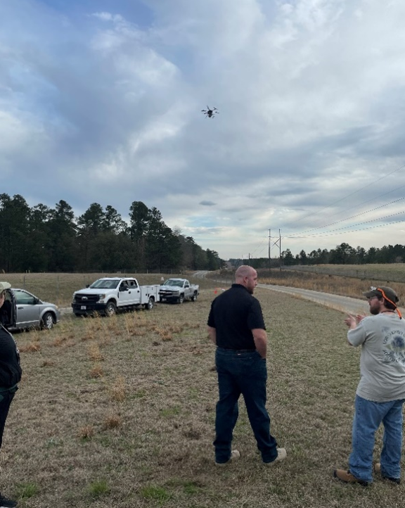
SRNL researchers use a drone to conduct LiDAR surveys. Photo by Hansell Gonzalez-Raymat (SRNL).